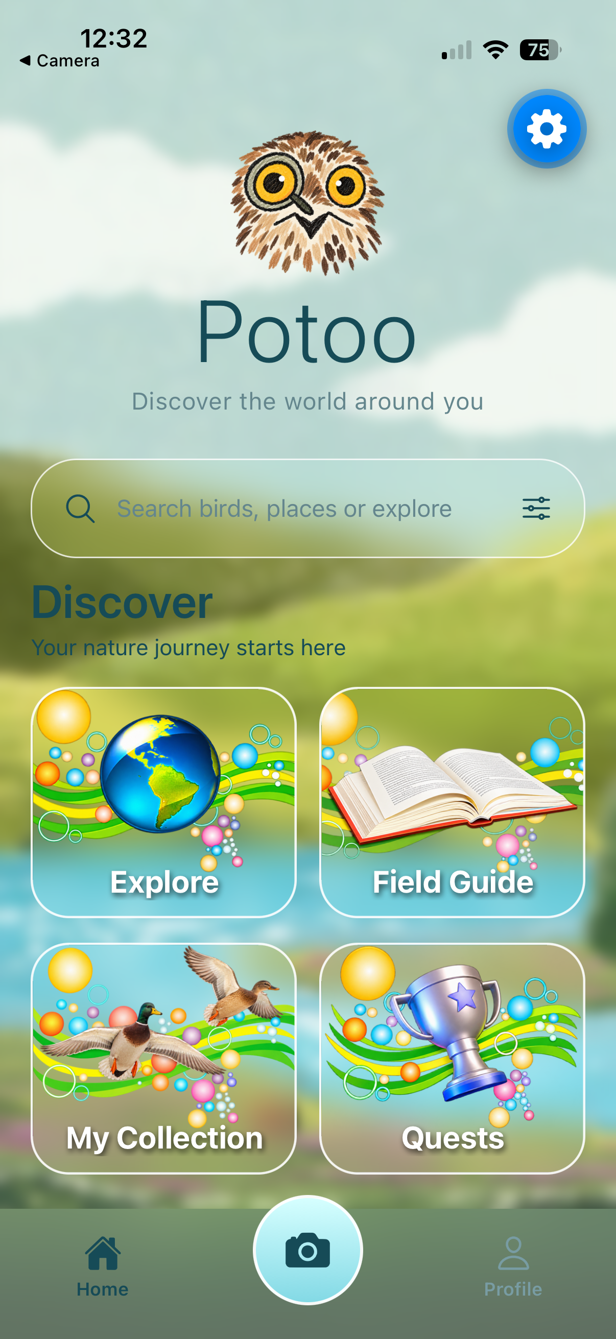
Home
The main landing screen and entry point to Potoo's four primary areas.
Discover the world around you.
A mobile nature companion that connects local wildlife discovery, field-guide learning, and outdoor exploration. Potoo is designed to help people become more curious and confident naturalists — while keeping the experience rooted in the real world.
Potoo explores how mobile technology and game-inspired design can make nature observation more accessible. The concept brings together nearby outdoor places, a location-aware bird field guide, camera-based observation, and a longer-term idea for personal collections and exploration challenges.
The intended audience ranges from beginning naturalists and students to outdoor enthusiasts and experienced birdwatchers. A beginner should be able to use Potoo to learn what lives nearby and build identification confidence; a more experienced birder should be able to use local discovery tools and keep track of encounters. The design aims to make getting started feel approachable without removing the depth that makes nature observation rewarding.
The project began with a simple question: how can an app encourage someone to notice more of the natural world around them? Rather than making the phone the center of the experience, Potoo is intended to help users prepare for an outing, use the app briefly when useful, and then return their attention to the landscape, wildlife, and sounds around them.
Check which birds have been observed in the surrounding area.
Find a park, natural area, or outdoor place to visit.
Look and listen first; use the camera when documentation is useful.
Use species information to build recognition and naturalist knowledge.
Over time, build a record of discoveries and return to new places.
The current project is a runnable React Native application with working navigation, a location-aware bird field guide, and a functioning camera capture flow. Other parts of the experience are at different stages of prototyping. The distinction matters: Potoo is a working mobile prototype, not yet a fully connected observation platform.
Status reflects the latest development update provided for this portfolio page. Features may evolve as the prototype develops.
Screenshots are loaded directly from the existing Flask static/ directory.
The filenames below match the assets already in the project.
The main landing screen and entry point to Potoo's four primary areas.
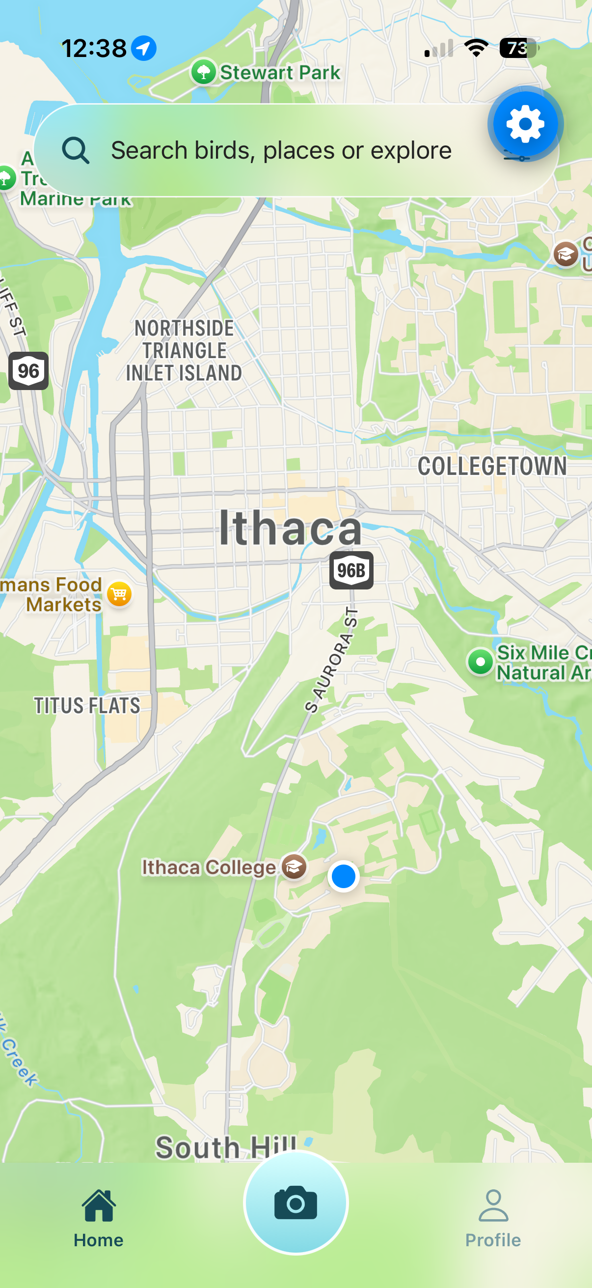
The map interface for discovering nearby outdoor points of interest.

Nearby bird species retrieved using location and iNaturalist observation data.

The in-app camera experience for capturing a wildlife observation.

The collection interface. Current entries are sample content.
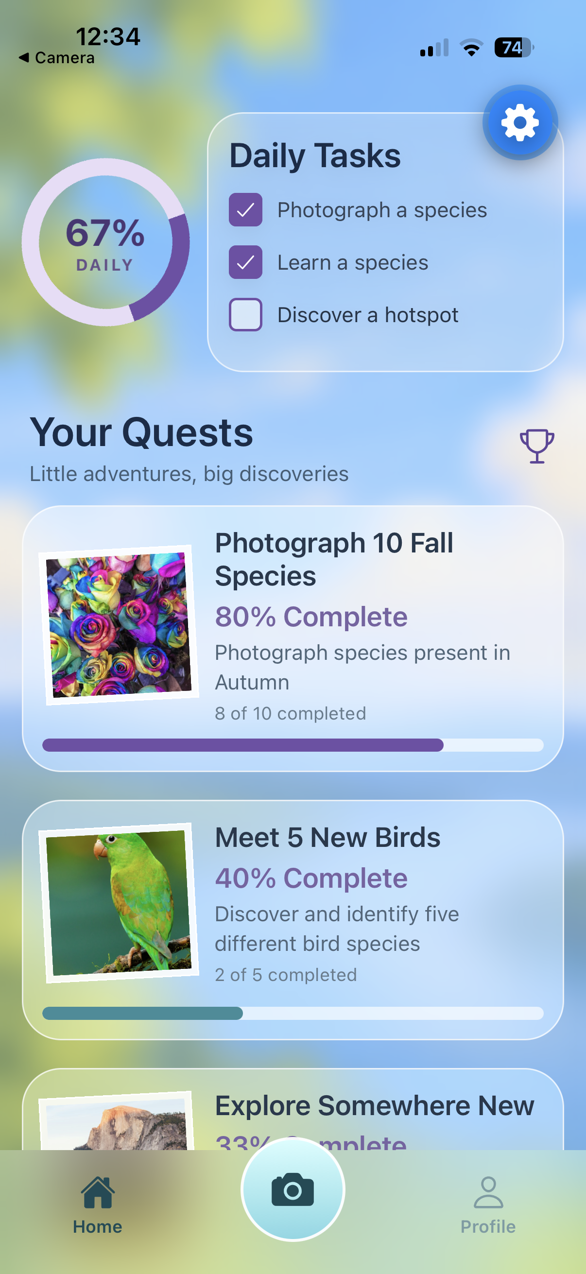
The challenge and progression concept. Current entries are sample content.
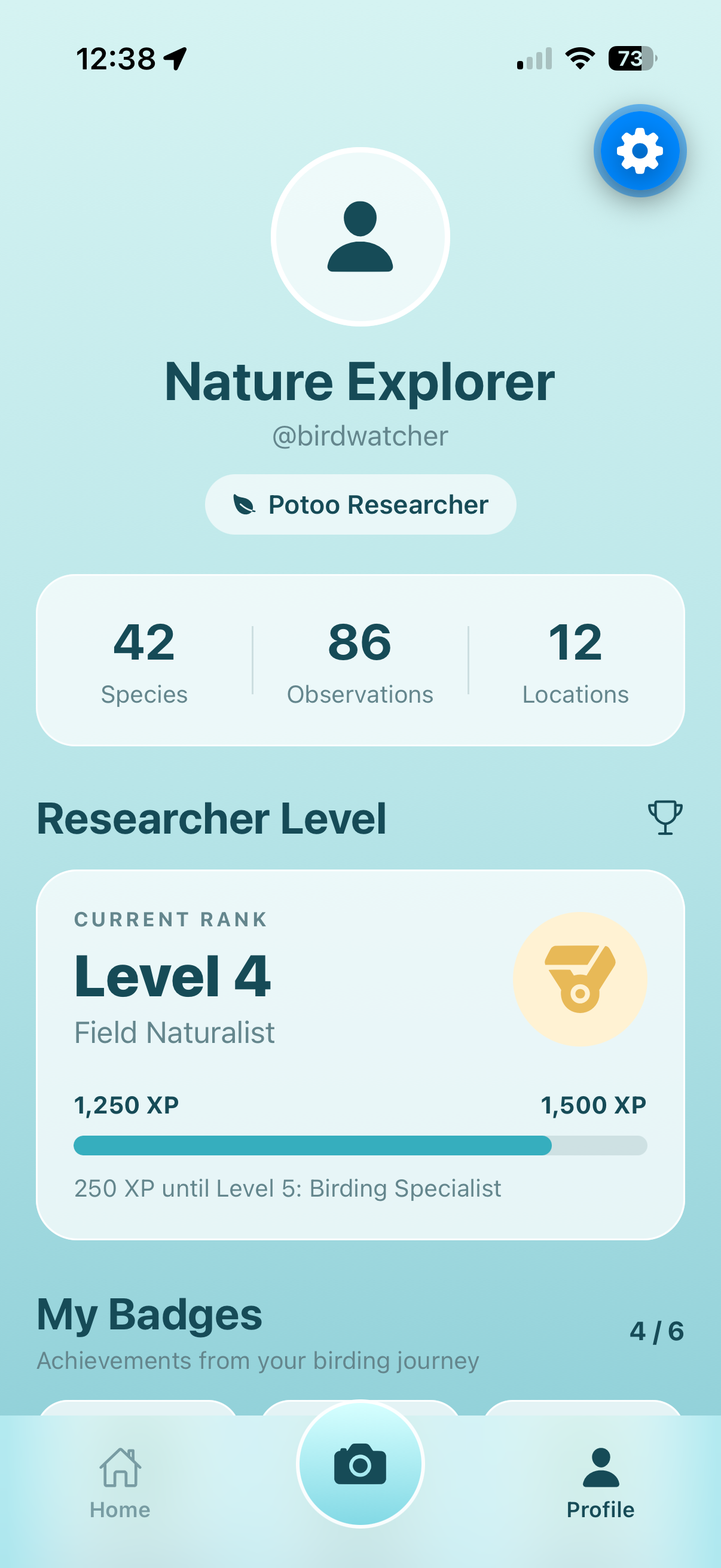
The user's naturalist profile, discovery summary, and achievement overview. Current profile values are sample content.
An Apple Maps-based view intended to help users find parks, natural areas, and other outdoor points of interest. The current map implementation is present, with the discovery experience still being refined.
Uses foreground location permission and the iNaturalist API to retrieve bird species observed within a local radius. Results include species names and observation counts, with search and refresh states.
Provides a live camera preview, permission request, photo capture, and retake flow. Capturing an image is implemented; automatic species identification and saving observations are not currently claimed as implemented.
A scrapbook-like place to represent a user's species discoveries and observation history. The current screen demonstrates the intended interface with sample profile and observation content.
A game-inspired layer for optional outdoor goals and learning challenges. The current screen uses example tasks and progress values rather than a persistent quest system connected to real observations.
A home screen provides entry points to the main app areas, supported by a bottom-tab navigation structure for moving between screens.
The original product plan describes an observation workflow that begins outside the app: a person notices a bird, watches and listens, and remembers useful details. Afterward, they can enter what they recall and work through guided clues about appearance, habitat, behavior, season, and calls before receiving feedback. The identified species can then become part of My Collection. This is an important part of the product vision, but the guided identification flow and saved observation system are not yet implemented in the current build.
The broader Potoo concept includes guided, clue-based identification after an observation: users recall details such as color, shape, habitat, behavior, season, or calls and use those clues to narrow down a species. This remains part of the intended experience rather than a feature represented as complete in the current app build.
Potoo uses a soft aqua and blue-green palette, nature-inspired imagery, rounded interface elements, and translucent glass-style feature cards. The goal is to make the app feel welcoming and exploratory rather than like a dense scientific database.
Potoo draws inspiration from tools such as Merlin Bird ID and iNaturalist, while exploring a different combination of local discovery, beginner-friendly learning, and optional game-inspired progression.
A reference for accessible bird identification, species information, and helping people connect observations with likely species.
A reference for location-linked biodiversity observations and community-supported species knowledge. Potoo currently uses its API for nearby bird species data.
The original comparative research looked at Merlin Bird ID and iNaturalist to identify useful patterns as well as opportunities for a different experience.
What informed Potoo: accessible identification tools, regional bird information, and useful species profiles.
Where Potoo differs: the concept adds optional quests, collection progression, and a more deliberate clue-based learning process rather than centering the whole experience on fast identification.
What informed Potoo: location-linked observations and the ability to explore organisms beyond birds. Its API also supplies nearby bird observation data to the current Field Guide.
Where Potoo differs: the interface aims to be more focused for beginners and to keep social posting and extended screen interaction out of the center of the experience.
A student or casual walker who enjoys local parks but is still learning how to recognize birds.
Design need: approachable species information, useful local context, and low-friction exploration.
An outdoor enthusiast who visits natural areas regularly and wants to discover new places and species.
Design need: relevant local discovery and tools that complement, rather than interrupt, observation.
Someone who enjoys being outdoors but may not yet think of themselves as a naturalist.
Design need: clear entry points, approachable challenges, and a reason to keep exploring.
The Figma design documents the early structure and visual direction that informed the current mobile prototype.
Potoo developed through a sequence of wireframing, design review, prototype requirements, and revisions. The project documentation records not just the intended screens, but the reasoning behind changes to the map, Field Guide, collection, and observation experience.
The early wireframes established Home as the starting point, with Explore, Field Guide, My Collection, and Quests as the four primary feature areas. The navigation plan also separated the main Observation flow and Profile from those feature screens. The later mockups explored a more distinctive visual language: a nature-themed home screen, map-based discovery, a botanical field-guide treatment for species pages, and a notebook or scrapbook style for personal records.
The initial home screen risked having too many competing elements. The design review called for a clearer visual hierarchy around search and the main exploration features.
Map pins needed to communicate why a place was worth visiting. The proposed improvement was selectable markers with hotspot details and potentially observable species.
The Field Guide was planned around common and scientific names plus identification information. Collection cards were envisioned with species images, dates, locations, and observation counts.
Define persistent navigation, the Home dashboard, Explore map with placeholder markers, searchable Field Guide, sample Collection cards, and sample Quests. The test plan focused on launch, navigation, screen access, and the expected placeholder content.
Refine the Explore map so markers can reveal hotspot details and potentially observable birds. Improve searchable species details, and define a guided observation process in which users enter characteristics and work through identification questions before viewing a result.
Potoo is currently built as a mobile application using React Native and Expo. The code is organized around reusable React Native components and screen-level state, with native device capabilities used for location, mapping, and camera access.
A future data layer could connect captured observations, identified species, collection entries, and quest progress. That would turn the current interface prototypes into a continuous user experience. This is a future development direction, not a claim about the current build.
Continue developing the Apple Maps experience, focusing on useful outdoor points of interest and a clear map interaction model.
Design a data model and storage approach so camera captures and species records can become saved observations.
Replace sample entries with a collection populated by the user's saved observations and identified species.
Connect challenge completion and progress to actual observations, species discoveries, and visits to new places.
These priorities follow the current prototype's most important gap: the core screens exist, but they do not yet share a persistent record of what a user has seen and learned.
Project source: Potoo on GitHub. The repository is the place to review the implementation alongside this project overview.